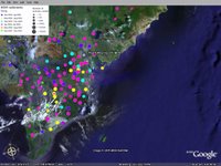
Pandemic Mashup

You've got to love the emergence of GIS mashups using Google Earth and this is the first example I've seen of a mashup displaying locations of H5N1 Avian Flu outbreaks. The data charts the location of every reported case of human infection since the outbreak began.
Declan Butler created the mashup for a Nature feature. On his blog he describes what it took to pull together the data.


0 Comments:
Post a Comment
Links to this post:
Create a Link
<< Home